

Politics


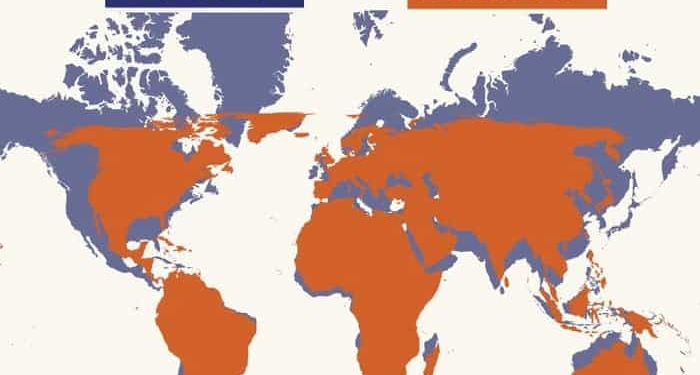
The United Nations has reportedly approved a new world map, with India and 163 other countries supporting the proposal, while the United States opposed it. The map has drawn attention for depicting India and Africa as larger than in the current representation. It also includes changes to the positioning and depiction of national borders, with some boundaries differing from the countries’ actual geographical borders.
The proposed map has sparked discussion over how countries and regions are represented on global maps. Supporters of the proposal believe the revised depiction offers a different perspective on the world’s geography, while the changes to borders and territorial representation have raised questions about accuracy and interpretation. The United States’ opposition has added further interest to the development.









Comments (0)
No comments yet
Be the first to comment!