
movies


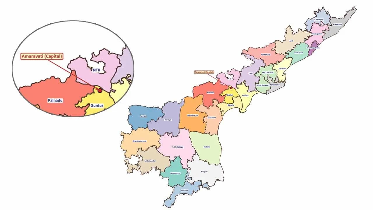
The Andhra Pradesh State Disaster Management Authority has released a new map of Andhra Pradesh showing a total of 28 districts. Earlier, the state had 26 districts, but with the addition of Polavaram and Markapuram as new districts, the number has increased. The updated map clearly highlights Amaravati as the state capital, bringing more clarity to the administrative structure.
This development comes after the approval of a bill in Parliament recognizing Amaravati as the capital of Andhra Pradesh. With this, the capital status of Amaravati has become stronger. The inclusion of the two new districts reflects important changes in the state’s geographical and administrative setup, which has now become a topic of discussion in both political and administrative circles.
Officials stated that these changes were made to improve governance, simplify administration and strengthen disaster management. The map also shows Amaravati as part of Guntur district. With this update, the state aims to ensure better planning and smoother development in the future. The new map has quickly gone viral on social media, attracting wide public attention.


Comments (0)
No comments yet
Be the first to comment!