General


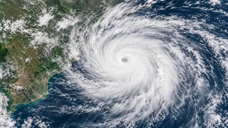
Cyclone Murasu, which formed over the west-central Bay of Bengal, has intensified into a severe cyclonic storm, according to the Meteorological Department. The system has been moving at a speed of 25 kmph over the past six hours. It is currently centred around 200 km from Chennai, 210 km from Nellore, 270 km from Machilipatnam, 310 km from Kavali, 330 km from Ongole and 470 km from Visakhapatnam. The cyclone is likely to cross the coast between Nellore and Narasapuram, near Ongole, from late Monday night to the early hours of Tuesday. During landfall, winds are expected to blow at speeds of 100–110 kmph, with gusts reaching up to 120 kmph.
The cyclone is expected to bring heavy to extremely heavy rainfall across the South Coastal Andhra and Rayalaseema regions on Monday and Tuesday. According to AP Disaster Management Authority Managing Director Prakhar Jain, heavy to extremely heavy rainfall is likely in parts of Krishna, Guntur, Bapatla, Prakasam, Markapuram and Nellore districts, with extremely heavy rainfall possible at isolated locations. Several areas in Eluru, East Godavari, West Godavari, NTR, Palnadu, Tirupati and Chittoor districts may also receive very heavy rainfall. Heavy showers are expected in parts of Alluri, Polavaram, Kakinada, Konaseema, Nandyal, YSR Kadapa and Annamayya districts. To deal with possible emergencies, six NDRF and seven SDRF teams have been kept on standby. Authorities have urged people to remain highly alert and follow official weather and safety advisories.















Comments (0)
No comments yet
Be the first to comment!